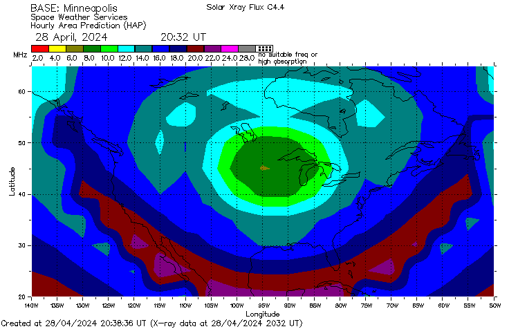
This HAP map shows the predicted highest frequency for base station to mobile communications. Though the map is centered in Minneapolis, Minnesota, a little mental translation will give you an idea of the conditions from Michigan to other parts of North America. For example, if you want to talk to other people in Michigan on 80 meters: bright red (2 MHz) hovering over Michigan would be bad, and yellow (4 MHz), olive (6 MHz) or a higher color would be better.
This HAP map comes from the Australian government. http://www.ips.gov.au/